We provide site, GPR, utility mapping, bathymetry, and geophysical surveys, along with hydrological, geotechnical, and topographical investigations—delivering accurate, reliable, and technology-driven solutions.
Modern India Survey Consultancy is a professionally managed surveying and consultancy firm providing integrated survey, geophysical, and engineering solutions across India. Our services include site surveys, GPR surveys, utility mapping surveys, bathymetry surveys, geophysical surveys (ERT, SRT, MASW, Cross hole seismic, Downhole seismic), hydrological surveys, geotechnical investigations, land and topographical surveys, and DGPS and Total Station surveys. We serve the civil engineering, mineral, hydrological, and environmental industries, delivering accurate data, reliable analysis, and technology-driven solutions for infrastructure and development projects.
We adopt industry-proven methodologies and state-of-the-art equipment—including DGPS, Total Station, GPR, ERT, SRT, MASW, bathymetry, and geotechnical tools—backed by skilled professionals and a structured approach to quality and reporting.

Total Station and DGPS (Static & RTK) for contour maps, spot levels, plans horizontal ±10 mm + 1 ppm, vertical ±15 mm + 1 ppm. CAD & GIS output.

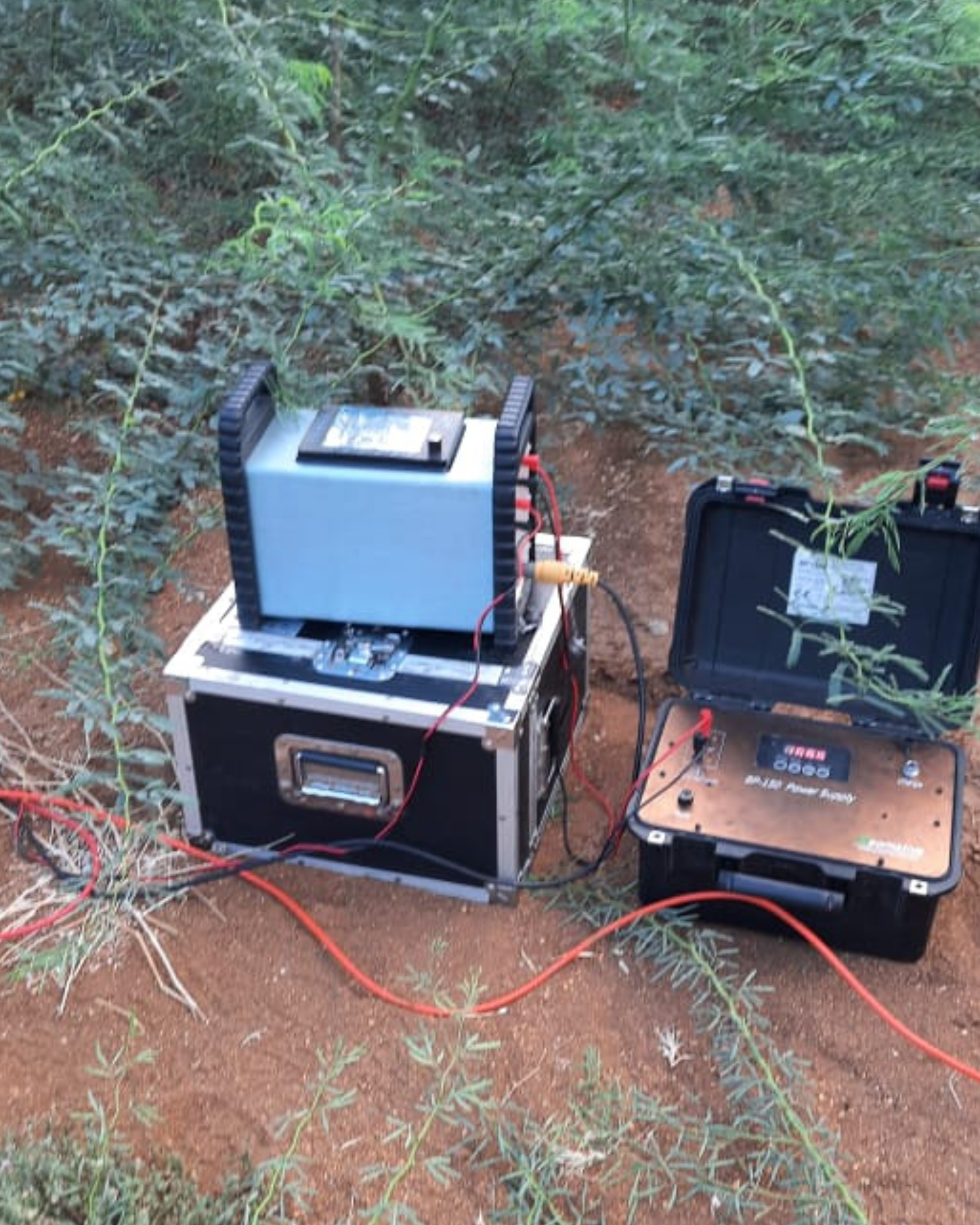
ERT to 100 m, SRT to 30–40 m, MASW, Cross hole and Downhole seismic for Vs profiles and site classification. 2D/3D resistivity and velocity models.

Echo sounder + DGPS for rivers, lakes, reservoirs depth contours and volume. Boreholes, SPT, lab testing and soil investigation reports.

Dual-frequency GNSS; Static, Fast Static, RTK. Horizontal ±5 mm + 1 ppm, vertical ±10 mm + 1 ppm. Control points and coordinate reports.

Electromagnetic detection and GPR for water, sewer, electrical, telecom, gas. Depth accuracy ±10% of depth; utility maps with coordinates.

160–900 MHz antennas and detection up to 6–8 m. Utilities, voids, rebar, cavities. Radargrams, interpreted profiles, and CAD overlays.


A selection of our recent and representative work across infrastructure, mining, water, and environmental sectors. Each project was delivered with a focus on accuracy, timeliness, and client collaboration.
Exploration surveys, resource modelling, mine planning support, and geotechnical assessment for open-pit and underground operations. Experience across coal, metals, and industrial minerals.
Site investigations for roads, railways, tunnels, and buildings, foundation studies; slope stability, and construction-phase verification. Compliance with MoRTH, IRC, and client specifications.
Transmission corridor surveys, substation site investigations, and subsurface utility mapping for power and telecom. Reducing risk of utility strikes and delays.
Utility mapping for urban renewal, GIS for municipal asset management, and geotechnical input for high-rise and metro projects. Integration with BIM where required.
At Modern India Survey Consultancy, we proudly collaborate with organizations that rely on accurate data and dependable insights. Our clients trust us for precision, transparency, and timely delivery across every project. We believe strong partnerships lead to better decisions and measurable results.
Tell us your requirements and we’ll provide a detailed quote. Our team is available for site visits, technical discussions, and proposal presentations.